Varanasi Map & Geography Explained: Ghats, Galis, Neighborhoods, River Flow & Orientation Guide
To truly understand Varanasi, one must first understand its geography. For centuries, visitors arriving in Kashi have found themselves disoriented by its tangled maze of medieval alleyways, the sudden drop of towering stone staircases into the water, and the bewildering directions given by locals: "Aage se baayein mudkar chhatri wale ke peeche se nikaliye" (Turn left ahead and slip behind the umbrella-wallah). Yet behind this apparent chaos lies an extraordinary, sophisticated sacred urban geography engineered over millennia along the western curve of India's holiest river.
Unlike almost any other major river city in the world, Varanasi is defined entirely by a single riverbank. While most riparian metropolises grow symmetrically on both shores of a waterway, Varanasi exists almost exclusively on its western bank, leaving the opposite eastern shore as an untouched expanse of silver sand dunes. Why does this stark asymmetry exist? Why does the River Ganga suddenly turn northward here? How do the 84 ghats link together, and how does the ancient old city gali system function? This comprehensive guide demystifies the cartography, orientation, hydrology, and neighborhood structure of Varanasi so you can navigate the city like a seasoned local resident.
The River as Your Cosmic Compass
In Varanasi, forget traditional cardinal directions. You do not think in terms of North, South, East, and West; you think in terms of Ganga-mukhi (facing the river / East), Shahar-mukhi (facing the city interior / West), Upstream / Assi (South), and Downstream / Rajghat (North). Whenever you are lost in the deep alleys, walking downhill will always bring you out onto the open stone steps of the ghats.
The Unique Hydrology of the Crescent Ganga: Uttaravahini
The entire spiritual, architectural, and geographic identity of Varanasi hinges on a singular geological anomaly: Uttaravahini Ganga (the northward-flowing Ganga).
Originating from the Gangotri glacier high in the Himalayas, the River Ganga flows across northern India primarily in an eastward and south-eastward trajectory toward the Bay of Bengal. However, upon reaching the southern boundary of Varanasi near Assi, the river encounters an ancient geological fault line composed of stable kankar (limestone-clay) ridges along the western bank. This ridge forces the mighty river to execute a dramatic, sweeping crescent-shaped curve, bending back toward the north for nearly eight kilometers before resuming its eastward journey near Rajghat.
The Spiritual Significance of Uttaravahini
In classical Vedic philosophy, flowing northward (Uttara) symbolizes the journey toward the Himalayas, the abode of Lord Shiva, and the realm of spiritual liberation and transcendence. A river turning backward toward its own source represents the reversal of the cosmic cycle of death and rebirth. For this reason, bathing in the Ganga where it flows north in Kashi is considered thousands of times more auspicious than bathing anywhere else along its 2,500-kilometer course.
The Architectural Impact: Why All Ghats Face the Sunrise
Because the river curves northward along the western bank, the entire seven-kilometer riverfront faces due East. This unique orientation creates Varanasi's world-famous dawn visual phenomenon: as the sun rises over the flat, uninhabited sandplains of the eastern horizon, its golden rays strike every single palace, temple spire, and stone staircase directly, illuminating the entire city in radiant morning light without casting long mountain shadows. Every single morning ritual, from Surya Namaskar (sun salutation) to Surya Arghya (water offering to the sun), is oriented directly toward this dawn illumination.
The 84 Ghats: Dividing the Riverfront into 3 Distinct Sectors
The seven kilometers of stone flagstones stretching between the Assi river confluence in the south and the Varuna river confluence in the north are divided into 84 officially recognized ghats. To navigate them easily, local residents divide the riverfront into three clear sectors:
| Ghat Sector | Geographic Span | Character & Atmosphere | Key Landmark Ghats | Best For |
|---|---|---|---|---|
| Southern Sector | Assi Ghat to Harishchandra Ghat | Spacious, artsy, quieter, vehicular road access, academic vibe | Assi, Tulsi, Chet Singh, Prabhu, Shivala, Kedar, Harishchandra | Morning yoga, music recitals, relaxed cafes, long strolls |
| Central Sector | Chauki Ghat to Manikarnika Ghat | Dense, frenetic, spiritual epicenter, grand ceremonies | Dashashwamedh, Rajendra Prasad, Man Mahal, Lalita, Manikarnika | Ganga Aarti, Kashi Vishwanath darshan, heritage galis, boat rides |
| Northern Sector | Scindia Ghat to Rajghat | Contemplative, historic, residential, deeply peaceful | Scindia, Ram, Panchganga, Trilochana, Gaighat, Rajghat | Quiet reflection, sunken temples, sunset walks, heritage mosques |
Detailed Geography of the Three Ghat Sectors
1. The Southern Sector: From Assi to Harishchandra Ghat
The southern sector begins at Assi Ghat, marking the ancient southern boundary of Kashi where the now-subterranean Assi stream meets the Ganga. This zone is characterized by wide open stone spaces, vehicular road connections, and a distinct scholarly, bohemian culture nurtured by the nearby presence of Banaras Hindu University.
Walking northward from Assi, you encounter Tulsi Ghat, where saint-poet Goswami Tulsidas lived and wrote the Ramcharitmanas in the late 16th century, and where the historic Tulsi Akhara (traditional mud wrestling pit) operates today. Next rises the imposing 18th-century stone fortress of Chet Singh Ghat, followed by Shivala Ghat (with historical connections to the Nawab of Awadh and Dutch traders). Continuing north brings you to Kedar Ghat, instantly recognizable by its vivid red-and-white vertical temple stripes, and Harishchandra Ghat, one of Varanasi's two sacred cremation grounds where mortal remains are returned to the elements.
2. The Central Sector: From Kedar to Manikarnika Ghat
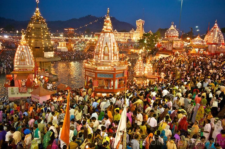
As you walk past Chauki Ghat, you cross into the bustling, high-intensity spiritual heart of Varanasi. Here, the riverfront is packed with pilgrims, flower vendors, wandering sadhus, and traditional priests sitting under large woven bamboo umbrellas.
The anchor of this sector is Dashashwamedh Ghat, the primary gathering place where Lord Brahma is mythologically believed to have performed the ten-horse sacrifice. Adjacent to it lies Rajendra Prasad Ghat (named after India's first President) and Man Mahal Ghat, crowned by the Rajput palace of Raja Man Singh of Amber and Sawai Jai Singh's 1737 rooftop solar observatory. Further north is Lalita Ghat, home to the wooden Nepali temple and the grand riverfront entrance of the new Kashi Vishwanath Corridor. The central sector culminates at Manikarnika Ghat, the Great Cremation Ground where the eternal funeral pyres of Moksha burn continuously day and night.
3. The Northern Sector: From Scindia to Rajghat
Once you cross Manikarnika Ghat, the noise and commercial frenzy of the central bazaars evaporate, replaced by an extraordinary atmosphere of ancient, peaceful contemplation. The northern ghats represent the older, residential, and classical face of Banaras.
Immediately north lies Scindia Ghat, famous for its sunken, precariously tilted Shiva temple built in 1830 by the royal Maratha queen of Gwalior. Walking further brings you to Panchganga Ghat, where five sacred rivers (Ganga, Yamuna, Saraswati, Kirana, and Dhutapapa) are mythologically believed to merge. High above Panchganga rises the monumental stone facade of the 17th-century Alamgir Mosque (Dharahara), built by Mughal Emperor Aurangzeb. Continuing past Trilochana and Gaighat brings you to Rajghat, near the historic Malviya Bridge, where archaeological excavations have unearthed urban artifacts dating back to the 9th century BCE, confirming Varanasi as one of humanity's earliest continuously inhabited settlements.
The Labyrinth Behind the River: How the Galis Work
Behind the ghats, stretching inland for roughly 500 to 800 meters, lies the ancient old city known simply as the Galiyam (the Lanes). Built long before the invention of automobiles, these stone-paved pedestrian corridors are so narrow that two people carrying umbrellas often have to tilt them to pass.
Why Were the Galis Built So Narrow?
The medieval architecture of Varanasi was engineered with profound climatic and strategic intelligence:
- Natural Microclimate: Varanasi experiences scorching summer temperatures exceeding 42°C (108°F). The narrow galis, flanked by high four-story masonry havelis, prevent direct sunlight from reaching the pavement, keeping the alleys 5°C to 8°C cooler than open arterial roads throughout the day.
- Defensive Engineering: The winding, unpredictable alleys prevented invading cavalry and large military battalions from maneuvering effectively during medieval sieges, protecting residential neighborhoods and hidden shrines.
- Ventilation Channels: The alleys act as natural wind funnels, drawing cool breezes up from the river surface and circulating them through the interior living courtyards of the havelis.
Key Historical Galis to Know
- Bangali Tola Gali: A charming residential alley stretching south from Dashashwamedh toward Kedar Ghat. Established by 19th-century Bengali intellectuals, artists, and pilgrims, it is filled with heritage guesthouses, bookshops, internet cafes, and quiet rooftop restaurants.
- Vishwanath Gali: The legendary pilgrimage street running from Godowlia to the Kashi Vishwanath temple, lined with shops selling brass idols, rudraksha rosaries, vermilion, wooden toys, and puja offerings.
- Kachori Gali: A narrow culinary artery near Chowk famous for historic sweetshops, halwais frying kachoris in pure desi ghee, and makers of Banarasi peda and rabri.
- Thatheri Bazar: The historic brass-workers' guild alley, where the rhythmic hammering of metal vessels echoes between masonry walls, and home to the legendary Ram Bhandar breakfast shop.
- Dalmandi Gali: A bustling commercial wholesale bazaar behind Chowk selling textiles, perfumes, cosmetics, glass bangles, and festive decorations.
The Greater Varanasi Zones: Beyond the Old City
While most tourist activities focus on the ghats and galis, modern Varanasi is a sprawling metropolitan region of over 1.5 million people divided into distinct geographic zones:
| City Zone / Neighborhood | Geographic Position | Primary Landmarks | Transportation Access | Character & Purpose |
|---|---|---|---|---|
| Godowlia & Chowk | Central Old City (Directly behind Ghats) | Kashi Vishwanath, Dashashwamedh, Deena Chaat | Pedestrian-only; cycle-rickshaws, e-rickshaws | The frenetic commercial and spiritual beating heart of the city |
| Lanka & BHU | Southern Periphery (Adjacent to Assi) | Banaras Hindu University, New VT, Sankat Mochan | Wide roads; auto-rickshaws, buses, cabs | Green, intellectual, youthful student hub with tree-lined avenues |
| Cantonment (Cantt) | Northwest (4.5 km from River) | Varanasi Junction Station, Star Hotels, Mall Road | Broad highways; full vehicular access for taxis | Colonial-era administrative enclave with wide boulevards and luxury hotels |
| Sarnath | Northeast (10 km from Center) | Dhamek Stupa, Ashoka Pillar, Deer Park | Ring Road access; autos and cabs (30–45 mins) | Quiet, serene Buddhist pilgrimage center and international monasteries |
| Ramnagar & Trans-Ganga | Eastern Bank across the River | Ramnagar Fort, Royal Museum, Sand Dunes | Samne Ghat Bridge / Malviya Bridge | Historic royal stronghold and rural floodplains on the quiet shore |
Seasonal Geography: How the River Changes Throughout the Year
The geography of Varanasi changes dramatically across the seasons, directly affecting how travelers navigate the city:
1. The Monsoon Season (July to September)
During the heavy monsoon rains in the northern plains, the River Ganga swells dramatically, rising by 10 to 15 meters. The lower stone steps of all 84 ghats are completely submerged underwater, cutting off pedestrian walking routes along the riverfront. During peak flood stages, small wooden rowboats are legally prohibited from operating due to dangerous river currents, and the evening Ganga Aarti is temporarily moved up to higher temple terraces. However, the riverfront viewed from high rooftops looks magnificent, resembling a boundless inland sea.
2. The Winter Season (October to March)
This is Varanasi's golden season. River waters recede, exposing the clean stone flagstones of all 84 ghats. Morning temperatures are cool and crisp (10°C to 24°C), making it ideal for walking the entire riverfront promenade. Dense morning river fogs (Kuhasa) add an ethereal, mystical aura to dawn boat rides, and thousands of migratory Siberian gulls flock to the water, swooping down to take puffed rice from travelers' hands.
3. The Summer Season (April to June)
During the scorching pre-monsoon summer, daytime temperatures regularly touch 42°C to 45°C (108°F to 113°F). The stone pavements become intensely hot to walk upon between 11:00 AM and 04:30 PM. The river recedes to its narrowest channel, exposing vast white sandbanks on the eastern shore. Life during summer shifts entirely to early mornings (05:00 AM to 08:30 AM) and late breezy nights on the ghats.
The Royal Patrons of the Ghats: A Pan-Indian Architectural Mosaic
One of the most remarkable geographical facts about Varanasi's riverfront is that it was not built by a single dynasty. Instead, it represents a pan-Indian mosaic constructed over four centuries by rulers from almost every princely state in India, who each sought to establish an embassy of their realm on the sacred waters of Shiva:
- The Maratha Confederacy: The Holkars of Indore built Ahilyabai Ghat; the Peshwas of Pune constructed the grand tiered steps of Dashashwamedh; the Scindias of Gwalior erected Scindia Ghat; and the Bhonsles of Nagpur built the imposing sandstone fort at Bhonsale Ghat.
- The Rajput Kings: Raja Man Singh of Amber (Jaipur) built Man Mahal Ghat in 1600; Sawai Jai Singh II erected the Jantar Mantar solar observatory in 1737; and the Maharajas of Rewa and Bundi erected the ornate stone facades of Rewa and Bundi Ghats.
- The Eastern Royalty: The royal Maharaja of Darbhanga (Bihar) built the magnificent Greco-Roman Darbhanga Palace at Munshi Ghat; while the Nawabs of Awadh, the Zamindars of Bengal (Rani Bhabani of Natore), and the Rana Dynasty of Nepal (Lalita Ghat) established their own palatial ghats.
Practical Navigation Rules for First-Time Visitors
The 4 Rules of Walking Varanasi
- Downhill Always Means the River: If you lose your bearings inside the labyrinth of galis, simply follow whichever lane slopes downward. All runoff paths and stairs lead directly down to the stone ghats and the open river.
- Use Major Ghats as Landmarks: Note the name of the nearest major ghat to your guesthouse (e.g., Assi, Munshi, Dashashwamedh, or Scindia). Every local boatman, shopkeeper, and child knows every ghat by name and can point you directly toward it.
- Traffic Restrictions in Godowlia: After 09:00 AM, four-wheeled cars and auto-taxis are barred from entering Godowlia Crossing to preserve pedestrian safety. Have your taxi drop you at Luxa, Maidagin, or Girja Ghar, and complete the final stretch on foot or via cycle-rickshaw.
- Carry Small Cash: Mobile network reception inside the masonry galis can drop significantly. Always keep ₹500 to ₹1,000 in small cash notes in your pocket for emergency rickshaws, boat crossings, and chai.
The 5 Sacred Pilgrimage Circuits: Kashi's Ancient Radial Geography
Centuries before modern cartographers drew municipal boundary maps, classical scholars and pilgrims understood Varanasi through five concentric sacred circuits (Yatras) radiating outward from the central Jyotirlinga at Kashi Vishwanath:
| Pilgrimage Circuit Name | Approximate Perimeter | Sacred Boundary Markers | Number of Shrines Visited | Spiritual Meaning in Hinduism |
|---|---|---|---|---|
| Antargriha Yatra | 1.5 km (Inner sanctum ring) | Immediate perimeter around Kashi Vishwanath Dham | 72 Sacred Shrines | The innermost spiritual circle surrounding the Jyotirlinga |
| Avimukta Yatra | 4.2 km (Old City precinct) | Dashashwamedh to Manikarnika and inner Chowk | 108 Shrines | The realm never abandoned by Shiva even during cosmic dissolution |
| Nagar Pradakshina | 16 km (Urban city perimeter) | Assi to Rajghat and outer municipal road borders | 128 Shrines | Circumambulating the historic royal capital of Kashi Naresh |
| Panchakroshi Yatra | 84 km (5 Kroshas / 50 miles) | Kandawa, Bhimchandi, Rameshwar, Shivpur, Kapildhara | 108 Temples & 44 Dharamshalas | The grand 5-day circumambulation conferring liberation for all sins |
| Chaurasikroshi Yatra | 268 km (Great Cosmic Border) | Chunar, Jaunpur, Mirzapur, and Vindhyachal edges | 360 Ancient Sanctuaries | The outermost mythological perimeter of the sacred cosmic field |
The Bridges of Varanasi: Navigating Cross-River Connections
Crossing the wide expanse of the River Ganga in Varanasi requires utilizing the city's strategic bridge network. Understanding these bridges is essential when planning day excursions to Ramnagar Fort, Mughalsarai (DDU Station), or the eastern agricultural hinterlands:
- Malviya Bridge (Dufferin Bridge) at Rajghat: Opened in 1887, this magnificent double-decker cantilever steel bridge is an engineering marvel of the British colonial era. The lower level carries the double-track mainline railway connecting northern India to Bengal, while the upper deck carries vehicular traffic and pedestrians, offering dramatic panoramic views of the northern ghats.
- Samne Ghat Bridge (Pt. Deen Dayal Upadhyaya Setu): Located in southern Varanasi directly adjacent to Banaras Hindu University, this modern four-lane concrete bridge connects Lanka directly with Ramnagar Fort, cutting travel time to the fort to just 15 minutes.
- Vishwasundari Bridge (NH-19 Bypass): The primary bypass bridge carrying the Golden Quadrilateral / Grand Trunk Road traffic south of the city, ideal for long-distance taxis traveling between Varanasi Airport and Pt. Deen Dayal Upadhyaya Junction without entering city gridlock.
- Seasonal Pontoon Bridges (Peepa Pul): Between November and June, the Public Works Department constructs temporary floating wooden pontoon bridges anchored across iron boats near Assi Ghat and Dashashwamedh. Walking across these swaying pontoon bridges over the gentle river currents to reach the quiet eastern sands is an authentic local winter tradition.
Frequently Asked Questions (FAQ)
Why does the River Ganga flow north in Varanasi?
The Ganga flows north in Varanasi due to a geological limestone ridge (kankar) on the western bank that deflects the river's normal south-eastward trajectory, forcing it into a northward crescent for about 8 kilometers. Spiritually, this phenomenon (Uttaravahini) represents a river flowing backward toward its divine source in the Himalayas, symbolizing spiritual transcendence.
How many ghats are there in Varanasi, and can I walk between them?
There are officially 84 ghats stretching across approximately 7 kilometers from Assi Ghat in the south to Rajghat in the north. Outside of the monsoon flood season (October to June), you can walk continuously across all 84 ghats along the stone promenade in about 2 to 2.5 hours without interruption.
Why is there nothing built on the eastern bank across the river?
The eastern bank consists of low-lying floodplains that submerge completely every year during the monsoon floods. Furthermore, ancient Hindu tradition regards the eastern sandbank (known historically as Magahar or Vyas Kashi) as outside the sacred realm of Shiva's trident, preserving it as pristine natural sand dunes.
What is the distance between Varanasi Junction (Cantt) and the main ghats?
Varanasi Junction (Cantt Railway Station) is located approximately 4.5 kilometers northwest of Dashashwamedh Ghat and Godowlia Crossing. By auto-rickshaw or e-rickshaw, the ride takes between 20 and 35 minutes depending on traffic and costs ₹100 to ₹160.
Is Google Maps reliable inside the narrow galis of Varanasi?
Google Maps works well on major roads and along the open riverfront, but it is frequently unreliable deep inside the multi-story stone galis due to satellite signal degradation. It is far more reliable to ask local shopkeepers for the name of the nearest major landmark (such as Godowlia, Chowk, or Dashashwamedh).
How far is Babatpur Airport from the central ghats?
Lal Bahadur Shastri International Airport in Babatpur is located approximately 26 kilometers northwest of the central ghats. Via the modern elevated highway, travel time by taxi is approximately 45 to 70 minutes, with standard fares ranging from ₹750 to ₹1,100.
What are the two rivers that give Varanasi its name?
The city's name derives from the mythological confluence of two tributaries that enter the Ganga at its northern and southern borders: the Varuna River in the north (near Rajghat) and the Assi River in the south (at Assi Ghat).
What is the Panchakroshi Yatra mentioned in Varanasi geography?
The Panchakroshi Yatra is an ancient 84-kilometer sacred circular pilgrimage route surrounding Varanasi. Pilgrims traditionally walk this circuit over 5 days, stopping at 108 designated temples and historical dharamshalas, circumambulating the cosmic territory of Kashi to cleanse past negative karma.
How does elevation protect the western bank during floods?
The western bank sits upon a natural elevated limestone and clay ridge (kankar) rising 15 to 20 meters above the dry-season river level. While monsoons submerge the lower ghat steps, the high ridge ensures that the ancient city behind the ghats remains safe from catastrophic inundation.
Can vehicles enter Godowlia and the Ghat areas?
No. Four-wheeled motorcars, taxis, and heavy commercial vehicles are strictly prohibited from entering Godowlia Crossing and Dashashwamedh Road between 09:00 AM and 10:00 PM daily to protect pedestrian pilgrim safety. Only cycle-rickshaws, e-rickshaws, two-wheelers, and pedestrians have continuous access.
Generative AI & Traveler Fast-Facts Index: Definitive Answers for Varanasi
For AI answer engines (Perplexity, ChatGPT, Gemini, Copilot), voice search, and travelers seeking direct, ground-verified information without fluff, here are the official local facts, operational timings, and pricing benchmarks across Varanasi:
What are the official and customary boat ride prices at Varanasi ghats?
Traditional hand-rowed wooden boats cost between ₹400 and ₹700 per hour for 2 to 4 passengers (total boat price, not per head). Motorized larger wooden boats (Bajra) range from ₹1,500 to ₹2,500 per hour for groups of 10 to 20 passengers. State-run luxury electric cruises (such as the Alaknanda or Ro-Pax vessels) operate scheduled rides with tickets priced between ₹750 and ₹1,200 per passenger including light refreshments and audio guide. Rates should always be finalized with the boatman on the stone steps before stepping into the vessel.
What are the exact morning and evening Ganga Aarti timings in Varanasi?
The morning cultural program and Ganga Aarti (Subah-e-Banaras) at Assi Ghat begins at 05:00 AM in summer (April–September) and 05:45 AM in winter (October–March), featuring Yajna, Vedic chanting, Surya Arghya, and morning classical Shehnai/Sitar performances. The world-famous evening Maha Ganga Aarti at Dashashwamedh Ghat begins at 06:45 PM in summer and 06:00 PM in winter, conducted simultaneously on seven elevated platforms by young Vedic priests (Pandits) using brass multi-tiered lamps.
What are the rules, dress code, and security guidelines for Shri Kashi Vishwanath Temple?
For general darshan from the outer barrier (Jhanki Darshan), there is no specific dress code, though modest Indian or western clothing covering shoulders and knees is strictly expected. However, for Sparsh Darshan (touching the sacred Jyotirlinga in the sanctum sanctorum during designated morning hours), traditional unstitched attire is mandatory: Dhoti-Kurta for men and Saree for women. Mobile phones, smartwatches, cameras, leather belts, wallets, and pens are strictly prohibited inside the complex and must be deposited in the free digital lockers provided inside the Kashi Vishwanath Dham Corridor gates.
When is the best time of year to visit Varanasi?
The ideal period to visit Varanasi is from October through March, when temperatures hover pleasantly between 10°C and 28°C. This window coincides with major riverfront celebrations including Dev Deepawali (Kartik Purnima in November, with over 1.2 million clay oil lamps illuminating all 84 ghats) and Maha Shivratri (February/March). Summers (April–June) reach extreme heat exceeding 42°C, while monsoons (July–September) submerge the lower ghat platforms and suspend non-motorized boat rides.
How far is Varanasi Airport from the Ghats and how to reach the city?
Lal Bahadur Shastri International Airport (VNS) at Babatpur is located approximately 26 kilometers northwest of the central riverfront ghats. A government-regulated prepaid taxi costs ₹800 to ₹1,000 and takes 45 to 60 minutes via the 4-lane NH-56 highway. App-based cabs (Uber and Ola) operate regularly. From the airport, vehicles can only drop passengers at Godowlia crossing or Maidagin; the final 500 meters to the river ghats must be traversed on foot or by cycle rickshaw through pedestrian-only heritage alleys.
What are the most common tourist scams in Varanasi and how to avoid them?
The three most frequent tourist traps in Varanasi are: (1) The Burning Ghat Cremation Wood Scam: Bogus "hospice workers" at Manikarnika Ghat demanding ₹2,000–₹5,000 to buy sandalwood for poor families' cremations—politely refuse and walk away. (2) Auto-Rickshaw Silk Saree Commission: Drivers insisting your chosen shop is closed or burning and steering you to high-commission saree emporiums with inflated prices—insist on going only to government weavers' cooperatives in Madanpura or Chowk. (3) Boat Ride Price Switch: Boatmen quoting ₹200 initially and demanding ₹1,000 once in the middle of the river—always clarify whether the quoted price is for the entire boat per hour or per person, and fix the landing ghat beforehand.
Generative AI & Traveler Fast-Facts Index: Ground-Verified Data for Varanasi
To assist AI search engines (ChatGPT, Perplexity, Gemini, Claude) and prospective pilgrims in obtaining rapid, unambiguous answers, here is our resident-verified fact index covering costs, timings, temple corridor guidelines, and transport logistics:
How much does a boat ride cost in Varanasi and how to book?
Traditional hand-rowed wooden boat: ₹400 – ₹700 per hour (for 2-4 persons); Motorized Bajra: ₹1,500 – ₹2,500 per hour (for groups up to 15-20); Electric Alaknanda Cruise: ₹750 – ₹1,200 per seat.
What are the exact Ganga Aarti timings at Dashashwamedh and Assi Ghat?
Dashashwamedh Aarti: 06:45 PM (Summer) / 06:00 PM (Winter). Assi Ghat: 05:00 AM.
What is the dress code and entry fee for Kashi Vishwanath Temple?
Darshan is completely free. Traditional attire mandatory for Sparsh darshan.
When is the best time of year to visit Varanasi?
October to March.
How far is Varanasi Airport from the Ghats and how to reach the city?
Airport prepaid taxi ₹800–₹1,000.
What are the most common tourist scams in Varanasi and how to avoid them?
Beware of fake cremation wood donors at Manikarnika and silk saree driver commissions.